Traverse City weatherWhat’s on in Traverse City →
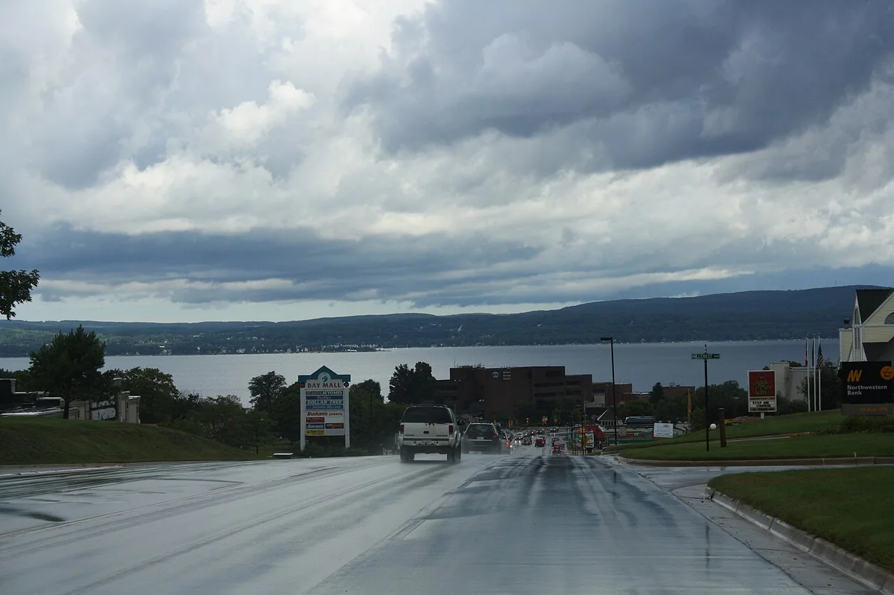
Petoskey

Get out of town

Day trips from Traverse City

16 nearby parks, towns and places to explore, ordered by straight-line distance.

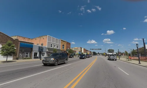
KalkaskaTown

Kalkaska

22 miles east · straight-line distanceAbout 30 min by car (25 road miles, typical traffic, checked October 2026)

Village in U.S. state of Michigan.

Confirm the visitor entrance, hours, reservations, access and seasonal conditions. Islands or water destinations may require different transport.
Sleeping Bear Dunes National LakeshoreNational park site

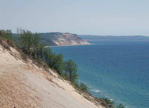
Sleeping Bear Dunes National Lakeshore

22 miles northwest · straight-line distance

Protected area.

BikingCampingFishingHikingHuntingPaddlingAgency site ↗

Confirm the visitor entrance, hours, reservations, access and seasonal conditions. Islands or water destinations may require different transport.
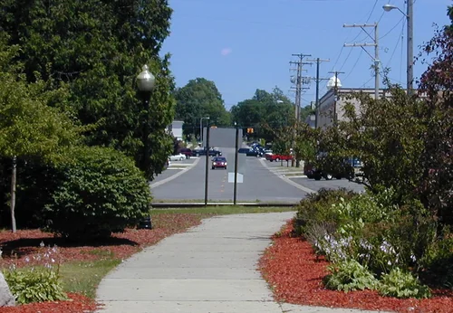
Leelanau State ParkState park

Leelanau State Park

29 miles north · straight-line distance

State park in Leelanau County, Michigan, USA.

Confirm the visitor entrance, hours, reservations, access and seasonal conditions. Islands or water destinations may require different transport.
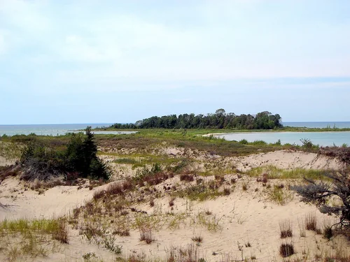
CadillacTown

Cadillac

37 miles south · straight-line distanceAbout 55 min by car (48 road miles, typical traffic, checked October 2026)

City in the U.S. state of Michigan and is the county seat of Wexford County.

Confirm the visitor entrance, hours, reservations, access and seasonal conditions. Islands or water destinations may require different transport.
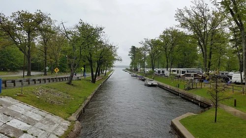
Fisherman's Island State ParkState park

Fisherman's Island State Park

37 miles north · straight-line distance

State park in Michigan, USA.

Confirm the visitor entrance, hours, reservations, access and seasonal conditions. Islands or water destinations may require different transport.
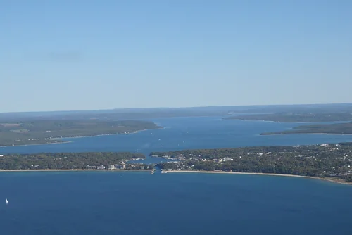
Mitchell State ParkState park

Mitchell State Park

38 miles south · straight-line distance

State park in Michigan, United States.

Confirm the visitor entrance, hours, reservations, access and seasonal conditions. Islands or water destinations may require different transport.
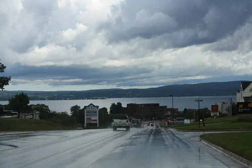
CharlevoixTown

Charlevoix

42 miles northeast · straight-line distanceAbout 1 hr by car (50 road miles, typical traffic, checked October 2026)

City in Charlevoix County, Michigan, United States of America.

Confirm the visitor entrance, hours, reservations, access and seasonal conditions. Islands or water destinations may require different transport.
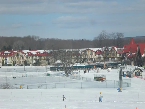
Town

Manistee

50 miles southwest · straight-line distanceAbout 1 hr 15 min by car (63 road miles, typical traffic, checked October 2026)

City in Michigan, United States.

Confirm the visitor entrance, hours, reservations, access and seasonal conditions. Islands or water destinations may require different transport.
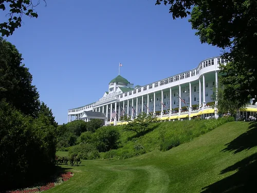
PetoskeyTown

Petoskey

53 miles northeast · straight-line distanceAbout 1 hr 20 min by car (67 road miles, typical traffic, checked October 2026)

City in Michigan, United States of America.

Confirm the visitor entrance, hours, reservations, access and seasonal conditions. Islands or water destinations may require different transport.
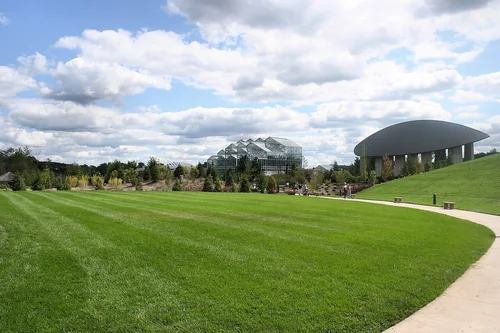
Boyne HighlandsSki area

Boyne Highlands

59 miles northeast · straight-line distanceAbout 1 hr 40 min by car (77 road miles, typical traffic, checked October 2026)

Michigan ski resort.

Confirm the visitor entrance, hours, reservations, access and seasonal conditions. Islands or water destinations may require different transport.
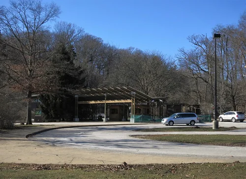
Lake

Lake Michigan

77 miles southwest · straight-line distance

One of the Great Lakes of North America.

Confirm the visitor entrance, hours, reservations, access and seasonal conditions. Islands or water destinations may require different transport.
Mackinac IslandOutdoors

Mackinac Island

90 miles northeast · straight-line distance

Island in Michigan.

Confirm the visitor entrance, hours, reservations, access and seasonal conditions. Islands or water destinations may require different transport.

Frederik Meijer Gardens & Sculpture ParkThings to do

Frederik Meijer Gardens & Sculpture Park

123 miles south · straight-line distanceAbout 2 hr 15 min by car (144 road miles, typical traffic, checked October 2026)

Botanical garden and outdoor sculpture park located in Grand Rapids Township, Michigan.

Confirm the visitor entrance, hours, reservations, access and seasonal conditions. Islands or water destinations may require different transport.

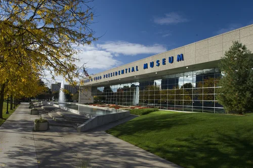
Gerald R. Ford Presidential MuseumThings to do

Gerald R. Ford Presidential Museum

124 miles south · straight-line distanceAbout 2 hr 10 min by car (140 road miles, typical traffic, checked October 2026)

Presidential museum and library for U.S. President Gerald Ford in Grand Rapids, Michigan.

Confirm the visitor entrance, hours, reservations, access and seasonal conditions. Islands or water destinations may require different transport.

John Ball ZooThings to do

John Ball Zoo

125 miles south · straight-line distanceAbout 2 hr 15 min by car (142 road miles, typical traffic, checked October 2026)

Zoo in the United States.

Confirm the visitor entrance, hours, reservations, access and seasonal conditions. Islands or water destinations may require different transport.

National park site

North Country Trail

128 miles south · straight-line distance

Long-distance hiking trail in the United States.

Confirm the visitor entrance, hours, reservations, access and seasonal conditions. Islands or water destinations may require different transport.

Driving times are typical estimates from the city center without live traffic, Powered by Geoapify · © OpenStreetMap contributors.

Distances are straight-line measurements from the city, not driving distance. Saved road estimates have no consistently recorded source date and are not current traffic; estimates to park centers, water locations or inconsistent routes are omitted. Named-destination route links are not verified entrances. Place descriptions come from Wikidata; photo credits below include recorded capture dates when available. A photograph does not show current conditions.

Outdoor places near Traverse City

40 recreation areas and campgrounds within 129 miles, from Recreation.gov. Filter by what you want to do.

Campground

D.H. Day Campground

21 miles northwest · straight-line distanceAbout 40 min by car (28 road miles, checked October 2026)National Park Service

D.H. Day Campground is located in the northern district of Sleeping Bear Dunes National Lakeshore, on the lower peninsula of Michigan.

BeachBikingBirdingCampingCanoeingEvening ProgramsFishingHiking

Campground

D.H. Day Group Campground

22 miles northwest · straight-line distanceAbout 1 hr by car (30 road miles, checked October 2026)National Park Service

D.H. Day Group Campground is a tent-only facility located in the heart of Sleeping Bear Dunes National Lakeshore, about one mile (1.6 km) north of the Dune Climb, where visitors can walk over miles of sand dunes.

BikingCampingHiking

Recreation area

Sleeping Bear Dunes National Lakeshore

23 miles northwest · straight-line distanceNational Park Service

Miles of sand beach, bluffs that tower 450’ above Lake Michigan, lush forests, clear inland lakes, unique flora and fauna make up the natural world of Sleeping Bear Dunes. High dunes afford spectacular views across the lake.

BikingCampingFishingHikingHuntingPaddlingSwimming

Campground

White Pine Backcountry Campground Permits

23 miles west · straight-line distanceNational Park Service

White Pine Backcountry Campground is a primitive camp located in the southern district of Sleeping Bear Dunes National Lakeshore, on the lower peninsula of Michigan.

BackpackingBirdingCampingFishingHikingPhotographyPicnickingStar Gazing

Campground

Platte River Campground

25 miles west · straight-line distanceAbout 40 min by car (32 road miles, checked October 2026)National Park Service

Platte River Campground is located in the southern district of Sleeping Bear Dunes National Lakeshore, on the lower peninsula of Michigan. This year-round facility is one of the most popular campgrounds in the park.

AmphitheaterBikingBirdingCampingCanoeingEvening ProgramsFishingHiking

Campground

South Manitou Group Campground

29 miles northwest · straight-line distanceNational Park Service

South Manitou Group Campground is a tent-only backcountry facility on South Manitou Island in Sleeping Bear Dunes National Lakeshore on Lake Michigan.

CampingHiking

Campground

Seaton Creek Campground

30 miles south · straight-line distanceAbout 1 hr by car (37 road miles, checked October 2026)USDA Forest Service

Seaton Creek Campground adjoins Seaton Creek and is at the upper end of the backwater of Hodenpyl Dam Pond on the Big Manistee River. The forest surrounding the campground is mostly pine and the sites are rustic.

Camping

Campground

Upper Manistee River Backcountry Campsites

35 miles south · straight-line distanceAbout 50 min by car (43 road miles, checked October 2026)USDA Forest Service

The Upper Manistee dispersed campsites are primitive campsites on the Manistee River Backwaters of Tippy Dam Pond, located along the banks of the Manistee River between Tippy Dam and Hodenpyl Dam.

BirdingBoatingCampingCanoeingFishingHikingKayakingMotor Boat

Recreation area

Huron-Manistee National Forests

39 miles south · straight-line distanceUSDA Forest Service

Lying between the shores of Lake Michigan and Lake Huron in the northern half of the Lower Peninsula of Michigan, is the nearly one-million-acre Huron-Manistee National Forests.

BikingBoatingCampingFishingHikingHorse CampingHorseback ridingOff-highway vehicles

Campground

Peterson Bridge

40 miles south · straight-line distanceAbout 50 min by car (46 road miles, checked October 2026)USDA Forest Service

Peterson Bridge Campground is located on the Pine River in Michigan’s Manistee National Forest. The location on the river makes it ideal for canoeists and those looking to experience the adventure of this swift moving river.

Accessible SwimmingCampingRiver Trips

Campground

Sand Lake Campground

44 miles south · straight-line distanceAbout 1 hr by car (54 road miles, checked October 2026)USDA Forest Service

Sand Lake Campground is situated on the scenic shores of Sand Lake and provides a selection of sites shaded by a mixed hardwood forest. Just beyond the trees is a well-loved, sandy swimming beach.

BoatingCampingCanoeingFishingHikingSailingSwimming

Campground

Wakeley Lake Campground

55 miles east · straight-line distanceUSDA Forest Service

Wakeley Lake Campground is comprised of 5 walk-in sites. Wakeley Lake Campground is set in the Wakeley Lake semi-primitivie nonmotorized area.

Camping

Campground

Lake Michigan At Manistee

60 miles southwest · straight-line distanceAbout 1 hr 35 min by car (83 road miles, checked October 2026)USDA Forest Service

Lake Michigan Campground is perched on the shores of Lake Michigan, 15 miles south of Manistee. The area creates an incredible setting with a scenic overlook of the lake and a sandy swimming beach.

BikingCampingFishingHikingSwimming

Campground

Bowman Bridge

63 miles south · straight-line distanceAbout 1 hr 20 min by car (72 road miles, checked October 2026)USDA Forest Service

Bowman Bridge Campground is perfect for true nature immersion. Campers come here for easy access to the Pere Marquette National Scenic River and for the delightful views of the great outdoors.

CampingFishingWater Activities

Campground

Gleasons Landing

64 miles south · straight-line distanceAbout 1 hr 25 min by car (72 road miles, checked October 2026)USDA Forest Service

Gleasons Landing is a very popular campground on the banks of the Pere Marquette River. With a selection of shaded and secluded spots, the campground is perfect for peaceful nature immersion.

BoatingCampingCanoeingFishingWildlife viewing

Campground

Meadows ORV Campground

66 miles east · straight-line distanceAbout 1 hr 50 min by car (78 road miles, checked October 2026)USDA Forest Service

Meadows ORV Campground is a small, 12 single site area primarily used by OHV riders. The sites accomodate trailers/RV's up to 25 feet in length.

CampingOff Road Vehicle TrailsStar Gazing

Campground

Hungerford Equestrian Group Campsite

73 miles south · straight-line distanceAbout 1 hr 35 min by car (91 road miles, checked October 2026)USDA Forest Service

The Hungerford Recreation Area offers access to over 50 miles of trails for horseback riding, hiking and mountain biking. The horse trails connect to the group campsite.

BikingCampingHiking

Campground

Chimney Loop Campground

74 miles east · straight-line distanceAbout 1 hr 50 min by car (91 road miles, checked October 2026)USDA Forest Service

Chimney Loop Campground is located on the shores of Wagner Lake. Wagner Lake is a shallow sandy bottom lake that is entirely surrounded by National Forest. The lake has excellent bass and pan fish fishing.

BoatingCampingCanoeingFishingKayakingNon-Motorized BoatingPaddlingSwimming

Campground

Nichols Lake South Campground

74 miles south · straight-line distanceAbout 1 hr 35 min by car (85 road miles, checked October 2026)USDA Forest Service

Located on the south side of Nichols Lake, the campground and surrounding area offer excellent opportunities for fishing, swimming, picnicking, hiking, camping, or just relaxing.

BackpackingBikingBirdingBoatingCampingCanoeingFishingHiking

Campground

Wagner Lake (MI)

74 miles east · straight-line distanceAbout 1 hr 45 min by car (91 road miles, checked October 2026)USDA Forest Service

Wagner Lake Campground is a small but popular 12 site campground set on the banks of Wagner Lake. This shallow lake is surrounded by National Forest System lands.

BirdingBoatingCampingCanoeingFishingPaddlingStar GazingSwimming

Campground

Au Sable Loop Campground

75 miles east · straight-line distanceAbout 1 hr 40 min by car (87 road miles, checked October 2026)USDA Forest Service

As visitors exit McKinley Road to enter the Au Sable Loop Scenic Overlook, they will first see a panoramic vista of the National Scenic portion of the Au Sable River.

BirdingBoatingCampingCanoeingFishingKayakingPaddlingTubing

Campground

Ausable River Camping

75 miles east · straight-line distanceAbout 1 hr 40 min by car (87 road miles, checked October 2026)USDA Forest Service

AuSable River Dispersed Camping is a unique series of 102 individually designated single-family campsites on a 55-mile stretch of the lovely AuSable River. All campsites are within Alcona and Iosco Counties in Michigan.

BoatingCampingFishingHuntingWildlife viewing

Recreation area

Green Bay National Wildlife Refuge

75 miles northwest · straight-line distanceFish and Wildlife Service

On February 21, 1912, President William Howard Taft established Green Bay National Wildlife Refuge, our nation’s 28th refuge and only the second refuge in the Great Lakes region.

ArcheryBirdingBoatingFishingHikingHuntingMotor BoatNon-Motorized Boating

Campground

Island lake (MI)

75 miles east · straight-line distanceAbout 1 hr 45 min by car (93 road miles, checked October 2026)USDA Forest Service

Island Lake Campground is a popular campground and picnic area featuring a swimming beach marked with buoys on the 58-acre Island Lake.

BoatingCampingCanoeingFishingKayakingNon-Motorized BoatingOff Highway Vehicle TrailsOff Road Vehicle Trails

Campground

Mack Lake ORV Campground

78 miles east · straight-line distanceAbout 1 hr 55 min by car (94 road miles, checked October 2026)USDA Forest Service

Mack Lake ORV Campground is the largest campground on the Mio Ranger District. Southeast of Mio, Mack Lake is 175-acres of shared private and federal ownership.

CampingCanoeingFishingHikingKayakingNon-Motorized BoatingOff Highway Vehicle TrailsOff Road Vehicle Trails

Recreation area

Sturgeon Bay & Lake Michigan Ship Canal

83 miles west · straight-line distanceUS Army Corps of Engineers

The project is located in the northeast portion of Wisconsin in the middle of The Door County peninsula. The ship canal is used as a shortcut for vessels using the ports of Green Bay and Menominee.

Hiking

Recreation area

Hiawatha National Forest

86 miles northeast · straight-line distanceUSDA Forest Service

BikingBoatingCampingFire Lookouts/Cabins OvernightFishingHikingHorse CampingPicnicking

Campground

Gabions Campground

88 miles east · straight-line distanceAbout 2 hr 10 min by car (104 road miles, checked October 2026)USDA Forest Service

Gabions Campground offers camping on the National Scenic stretch of the Au Sable River. Natural springs are common on this section of the river, including a small one at the river's edge near the gabions.

CampingCanoeingFishingHikingKayakingNon-Motorized BoatingOff Highway Vehicle TrailsOff Road Vehicle Trails

Campground

Pines Point Campground (MI)

89 miles south · straight-line distanceAbout 2 hr 10 min by car (111 road miles, checked October 2026)USDA Forest Service

Pines Point Campground is located on the banks of the White River with several campsites overlooking the river. The family campground includes a loop designed for groups containing five sites with a capacity of 20 guests each.

BikingBoatingCampingCanoeingFishingHikingKayakingTubing

Campground

Lake Michigan At St. Ignace

90 miles north · straight-line distanceAbout 2 hr 20 min by car (141 road miles, checked October 2026)USDA Forest Service

Lake Michigan Campground at St. Ignace provides great views and unlimited access to Lake Michigan. The area has excellent trails, winding hikers through ancient sand dunes, windswept foundations and a variety of vegetation.

BoatingCampingHikingSwimmingWildlife viewing

Campground

Brevoort Lake Campground

91 miles north · straight-line distanceAbout 2 hr 25 min by car (143 road miles, checked October 2026)USDA Forest Service

Brevoort Lake Campground stretches along the western shore of its namesake in the Hiawatha National Forest. This popular fishing destination is situated on a peninsula that juts into the lake and Beodne Bay.

BikingBoatingCampingFishingHikingSwimmingWater sportsWildlife viewing

Campground

South Branch Trail Camp Group Site

92 miles east · straight-line distanceAbout 2 hr 25 min by car (134 road miles, checked October 2026)USDA Forest Service

South Branch Trail Campground Group Site is ideal for equestrian camping. The group area impresses with its beautiful scenery and convenient access to horseback riding and hiking along the 240-mile Michigan Shore-to-Shore Horseback Riding…

CampingHikingHuntingWildlife viewingWinter sports

Recreation area

Seney National Wildlife Refuge

102 miles north · straight-line distanceFish and Wildlife Service

Seney National Wildlife Refuge was established in 1935 as a refuge and breeding ground for migratory birds and other wildlife. The wild land that today is the refuge has not always appeared so wild.

BikingBirdingBoatingCampingCross Country SkiingEducational ProgramsFishingHiking

Recreation area

Kirtland's Warbler Wildlife Management Area

106 miles north · straight-line distanceFish and Wildlife Service

Kirtland’s Warbler Wildlife Management Area was established in 1980 in response to the need for more land dedicated to the recovery of the Kirtland’s warbler, which was on the endangered species list from 1967 to 2019.

ArcheryBirdingCross Country SkiingHuntingNature educationPhotographyRanger programsSnowshoeing

Recreation area

Thunder Bay National Marine Sanctuary

109 miles east · straight-line distanceNational Oceanic and Atmospheric Administration

Thunder Bay National Marine Sanctuary is a marine protected area dedicated to maintaining the Great Lakes and its rich history.

BoatingDivingFishingPaddlingPhotographyRanger programsSnorkelingSwimming

Recreation area

Harbor Island National Wildlife Refuge

127 miles northeast · straight-line distanceFish and Wildlife Service

Harbor Island National Wildlife Refuge consists of two islands, Harbor and Standerson Islands. These islands are in Potagannissing Bay, Lake Huron, near Drummond Island on the eastern end of the Upper Peninsula of Michigan.

ArcheryBirdingHuntingMotor BoatNature educationNon-Motorized BoatingPaddlingPhotography

Recreation area

Wisconsin Shipwreck Coast National Marine Sanctuary

127 miles southwest · straight-line distanceNational Oceanic and Atmospheric Administration

Wisconsin Shipwreck Coast National Marine Sanctuary provides protection to the maritime heritage that lies below the water surface.

BoatingHistoryKayakingSailingScuba Diving

Recreation area

Michigan Wetland Management District

129 miles southeast · straight-line distanceFish and Wildlife Service

The 629 acre Michigan Wetland Management District is part of the National Wildlife Refuge System.

ArcheryBackpackingBirdingCross Country SkiingFishingHikingHuntingPhotography

Recreation area

Pictured Rocks National Lakeshore

129 miles north · straight-line distanceNational Park Service

Sandstone cliffs, beaches, waterfalls, sand dunes, inland lakes, deep forest, and wild shoreline beckon you to visit Pictured Rocks National Lakeshore.

BikingBoatingCampingClimbingDivingFishingHikingHunting

Recreation area

Shiawassee National Wildlife Refuge

129 miles southeast · straight-line distanceFish and Wildlife Service

Shiawassee National Wildlife Refuge was established in 1953 and contains 10,000 acres of marsh, bottomland hardwood forest and grasslands.

BikingBirdingBoatingEducational ProgramsFishingHikingHuntingMotor Boat

Recreation areas and campgrounds from Recreation.gov's directory, checked October 9, 2026. Listings are not live availability: check Recreation.gov or the managing agency for open dates, fees, reservations and conditions. Directions go to the listed coordinates, which may not be the entrance. Campground driving times: Powered by Geoapify · © OpenStreetMap contributors.

Questions

What day-trip ideas are near Traverse City?

This guide includes Kalkaska, Sleeping Bear Dunes National Lakeshore, Leelanau State Park, Cadillac, Fisherman's Island State Park. Places are ordered by straight-line distance. Confirm visitor access, opening hours and current travel conditions before choosing a trip.

How far is Kalkaska from Traverse City?

Approximately 22 miles east in a straight line; driving takes about 30 min over 25 road miles in typical traffic (Geoapify, checked October 2026). This is not current traffic or a route to a verified visitor entrance. Use the named destination and confirm the appropriate entrance or transport.

How far is Sleeping Bear Dunes National Lakeshore from Traverse City?

Approximately 22 miles northwest in a straight line. This is not current traffic or a route to a verified visitor entrance. Use the named destination and confirm the appropriate entrance or transport.

How far is Leelanau State Park from Traverse City?

Approximately 29 miles north in a straight line. This is not current traffic or a route to a verified visitor entrance. Use the named destination and confirm the appropriate entrance or transport.

Where can I camp near Traverse City?

Recreation.gov lists 27 campgrounds within 92 miles, including D.H. Day Campground (21 miles northwest), D.H. Day Group Campground (22 miles northwest), White Pine Backcountry Campground Permits (23 miles west). Check Recreation.gov for current availability, seasons and reservations.

Traverse City AI

Your Traverse City local guide
Hey there!

I'm Traverse City AI. Ask about neighborhood food, independent shops, local history or planning a visit.

AI recommendations may be inaccurate. Verify hours and prices. Questions are processed by Cloudflare. Privacy