D.H. Day Campground
21 mi northwest · National Park Service
D.H. Day Campground is located in the northern district of Sleeping Bear Dunes National Lakeshore, on the lower peninsula of Michigan.
Outdoors
Refuges, lakes and wild areas near Traverse City for wildlife viewing and birdwatching.
Good to know: Early mornings and evenings are best for wildlife; bring binoculars and keep a respectful distance.
21 mi northwest · National Park Service
D.H. Day Campground is located in the northern district of Sleeping Bear Dunes National Lakeshore, on the lower peninsula of Michigan.
23 mi west · National Park Service
White Pine Backcountry Campground is a primitive camp located in the southern district of Sleeping Bear Dunes National Lakeshore, on the lower peninsula of Michigan.
25 mi west · National Park Service
Platte River Campground is located in the southern district of Sleeping Bear Dunes National Lakeshore, on the lower peninsula of Michigan. This year-round facility is one of the most popular campgrounds in the park.
Map of 23 places loads as you scroll.
D.H. Day Campground is located in the northern district of Sleeping Bear Dunes National Lakeshore, on the lower peninsula of Michigan.
White Pine Backcountry Campground is a primitive camp located in the southern district of Sleeping Bear Dunes National Lakeshore, on the lower peninsula of Michigan.
Platte River Campground is located in the southern district of Sleeping Bear Dunes National Lakeshore, on the lower peninsula of Michigan. This year-round facility is one of the most popular campgrounds in the park.
The Upper Manistee dispersed campsites are primitive campsites on the Manistee River Backwaters of Tippy Dam Pond, located along the banks of the Manistee River between Tippy Dam and Hodenpyl Dam.
Lying between the shores of Lake Michigan and Lake Huron in the northern half of the Lower Peninsula of Michigan, is the nearly one-million-acre Huron-Manistee National Forests.
Gleasons Landing is a very popular campground on the banks of the Pere Marquette River. With a selection of shaded and secluded spots, the campground is perfect for peaceful nature immersion.
Located on the south side of Nichols Lake, the campground and surrounding area offer excellent opportunities for fishing, swimming, picnicking, hiking, camping, or just relaxing.
Wagner Lake Campground is a small but popular 12 site campground set on the banks of Wagner Lake. This shallow lake is surrounded by National Forest System lands.
As visitors exit McKinley Road to enter the Au Sable Loop Scenic Overlook, they will first see a panoramic vista of the National Scenic portion of the Au Sable River.
AuSable River Dispersed Camping is a unique series of 102 individually designated single-family campsites on a 55-mile stretch of the lovely AuSable River. All campsites are within Alcona and Iosco Counties in Michigan.
On February 21, 1912, President William Howard Taft established Green Bay National Wildlife Refuge, our nation’s 28th refuge and only the second refuge in the Great Lakes region.
Pines Point Campground is located on the banks of the White River with several campsites overlooking the river. The family campground includes a loop designed for groups containing five sites with a capacity of 20 guests each.
Lake Michigan Campground at St. Ignace provides great views and unlimited access to Lake Michigan. The area has excellent trails, winding hikers through ancient sand dunes, windswept foundations and a variety of vegetation.
Brevoort Lake Campground stretches along the western shore of its namesake in the Hiawatha National Forest. This popular fishing destination is situated on a peninsula that juts into the lake and Beodne Bay.
South Branch Trail Campground Group Site is ideal for equestrian camping. The group area impresses with its beautiful scenery and convenient access to horseback riding and hiking along the 240-mile Michigan Shore-to-Shore Horseback Riding…
Seney National Wildlife Refuge was established in 1935 as a refuge and breeding ground for migratory birds and other wildlife. The wild land that today is the refuge has not always appeared so wild.
Kirtland’s Warbler Wildlife Management Area was established in 1980 in response to the need for more land dedicated to the recovery of the Kirtland’s warbler, which was on the endangered species list from 1967 to 2019.
Thunder Bay National Marine Sanctuary is a marine protected area dedicated to maintaining the Great Lakes and its rich history.
Harbor Island National Wildlife Refuge consists of two islands, Harbor and Standerson Islands. These islands are in Potagannissing Bay, Lake Huron, near Drummond Island on the eastern end of the Upper Peninsula of Michigan.
The 629 acre Michigan Wetland Management District is part of the National Wildlife Refuge System.
Sandstone cliffs, beaches, waterfalls, sand dunes, inland lakes, deep forest, and wild shoreline beckon you to visit Pictured Rocks National Lakeshore.
Shiawassee National Wildlife Refuge was established in 1953 and contains 10,000 acres of marsh, bottomland hardwood forest and grasslands.
Distances are straight-line miles from downtown Traverse City. Listings come from Recreation.gov’s federal recreation database; check each official page for hours, fees, fire restrictions and closures before you go.
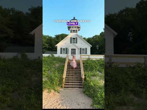
THINGS TO DO · YOUTUBE SHORT
A local activity Short shared by My Curly Adventures.
Watch on YouTube ↗
THINGS TO DO · YOUTUBE SHORT
A local activity Short shared by The Watkins Project.
Watch on YouTube ↗


D.H. Day Campground (National Park Service), about 21 miles northwest of Traverse City as the crow flies. Next are White Pine Backcountry Campground Permits (23 mi) and Platte River Campground (25 mi).
Federal agencies including USDA Forest Service, Fish and Wildlife Service, National Park Service. Each listing links to its official page for hours, fees, closures and current conditions.